British Trucking for UK Truck Drivers
British Trucking, the best products for truck drivers, plus the latest news and reviews to help make truck driving more enjoyable, we source the latest equipment and the best deals for UK truckers.
Truck Driving Products & Accessories
See our great selection of products Hand Picked for UK Truck Drivers
British Trucking News, Reviews, and Beginner Guides

Truck driving is a great job! At British Trucking, we provide you with valuable information if you are just starting out as a truck driver or considering driving as a career choice.
Weekly articles packed with information about truck driving in Britain, great topics such as British HGV license requirements, what you need to become a truck driver in the UK, truck driver product reviews, latest gadgets plus tools of the trade.
Take a look at our truck driver beginners guides with useful tips and tricks that can help new HGV drivers understand things like tachographs, on-site safety requirements, and much more.
Latest Trucking Articles
Not sure about what trucking items the market has to offer? Don’t worry, we have lots of great products in our shop section, plus, articles packed with all the latest truck driver gadgets and innovations, plus handy beginner guides for new truck drivers.
Latest Trucking Products
Best Truck Sat Nav 2024 Rated by British Trucking
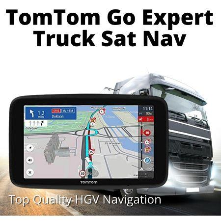
- Voice Control
- Multi Drop Routing
- Dedicated Large Vehicle POIs
- Traffic & Speed Camera Alerts
- Intuitive Interface
- Powerful Speaker
- Highest Resolution HD Touchscreen
- 4 x More Responsive
- Fast Updates Via Wi-Fi
Featured Trucking Products
British Trucking is an Amazon Powered Website all our products are hand-picked selecting the best trucking products available just for you!
Get 30 Day FREE Trial Amazon Prime